Nevada City, South Yuba River Mountain Bike Trail Map
|
|---|
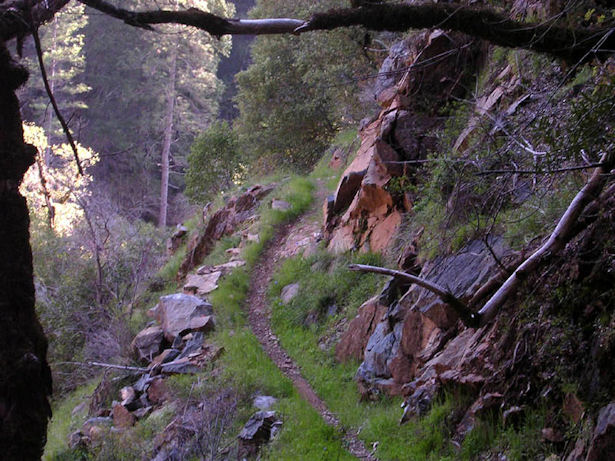
Nevada City Area Summary Description: The South Yuba River is the region's centerpiece, with a narrow and often technical single-track trail, pieced together from old mining routes, hugging the walls of the steep canyon formed by the river. The South Yuba Trail offers numerous out-and-back and loop ride options suitable for intermediate and advanced riders. The Pioneer Trail, a twenty-five mile trail connecting Nevada City to the high country near Grouse Ridge, gives beginners a perfect introduction to single-track. Built by local equestrian groups, the Pioneer Trail is a great example of the potential for cooperation between user groups. This single-track also connects to trails dropping down toward Scotts Flat Reservoir, making some great short loop possibilities. |
| The South Yuba Region is just one of the huge variety of mountain biking spots that the Northern Sierra has to offer. Discover more great rides. |
The trail map below is a jpeg of the actual maps from our books and map-sets. |
Nevada City Area Mountain Bike Trails Round Mountain Trails - Trail system tucked in between a residential area and the South Yuba River. Mostly intermediate to advanced riding through mixed forest. |
| Directions to trailhead(s): Ride 1. From intersection of Hwys. 20 and 49, head toward Downieville on Hwy. 49 for 0.3 miles, then turn right on North Bloomfield Road. In 0.6 miles stay right at intersection to remain on N. Bloomfield Rd. In 5.6 miles, turn left on Rock Creek Road. The trailhead parking is up the road 0.7 miles on the right side, just past the intersection with Merrimas Way. Ride 2. Follow instructions for Ride 1, but continue on North Bloomfield as it descends steeply to river. After crossing the river, the road turns to dirt and starts to climb. In 1.5 miles, turn right into the South Yuba campground and park in the day-use area. |