|
||||||
|---|---|---|---|---|---|---|
Mount Diablo State Park Mountain Bike Trail MapGuide to the best mountain
bike trails in Mount Diablo State Park.
|
|---|
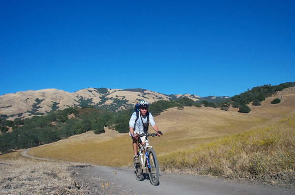 |
Area Summary Just as it reigns over lesser peaks in the East Bay skyline, Mount Diablo has a deserved reputation as the crown jewel of East Bay mountain biking. For sheer variety of terrain and quantity of trails, Diablo can't be beat. Mount Diablo also boasts stunning and sometimes unusual beauty, great views and a variety of wildlife. While rides of all levels can be fashioned, Diablo's bike trails definitely cater to strong intermediates and better. Though only a few sections of single-track are open, the fire roads tend to be steep and rugged. Be prepared to walk on some trails and use extra caution (seat down, weight back!) descending. A note about Diablo single-track. The official policy is that single-track trails are considered closed to bikes unless expressly designated as multi-use. However, in some instances there is substantial inconsistency between printed information, online information and trail signage as to whether a trail is multi-use.
|
| Check out our interactive Mountain Biking map of Mount Diablo State Park. |
Mount Diablo Trails Easier Trails Pine Canyon Road - Continuation of BBQ Terrace Road, through forested canyon with multiple stream crossings. Intermediate Level Trails Angel Kerley Road - Fire road cuts across semi-open hillside. Advanced Level Trails Wall Point Road - Steep though ridable fire road through mixed terrain. |
| Directions to trailhead(s): Mt Diablo is located in the Walnut Creek/Danville vicinity. For the main south entrance take the Diablo Road exit off I-680. Stay on Diablo Road as it heads northwest through the foothills. Follow signs to the park, which lead you up South Gate road. Macedo Ranch (ride 1) is located at the end of Green Valley Road, a left off of Diablo 1.4 miles from I-680. For Mitchell Canyon, take the Concord Ave. exit off Hwy. 242. Head east for .6 miles. Take a left on Clayton Road. Stay on Clayton Road for 5.5 miles. Take right on Mitchell Canyon Road. Trailhead is 1.5 miles ahead. |